Starting Earth Models
Mantle convection and the associated plate tectonics are some of the most fundamental yet complex processes here on Earth. The complexity arises from several physical processes governing the mantle circulation at different temporal and spatial scales. With the recent increase in the availability of computational resources and advanced numerical techniques, global mantle flow models have become possible to investigate the underlying physics of plate tectonics. Here, we will discuss one such model developed as part of the NSF-funded project, Integrated Geodynamic Earth Models.
We setup instantaneous mantle convection models using ASPECT, an open-source code that simulates problems in the Earth’s mantle, with the goal to reproduce present-day GPS velocities and deformation patterns. The material properties in our models are constrained using recent high-resolution geophysical observations. The main components of our models and corresponding parameter values are mentioned below:
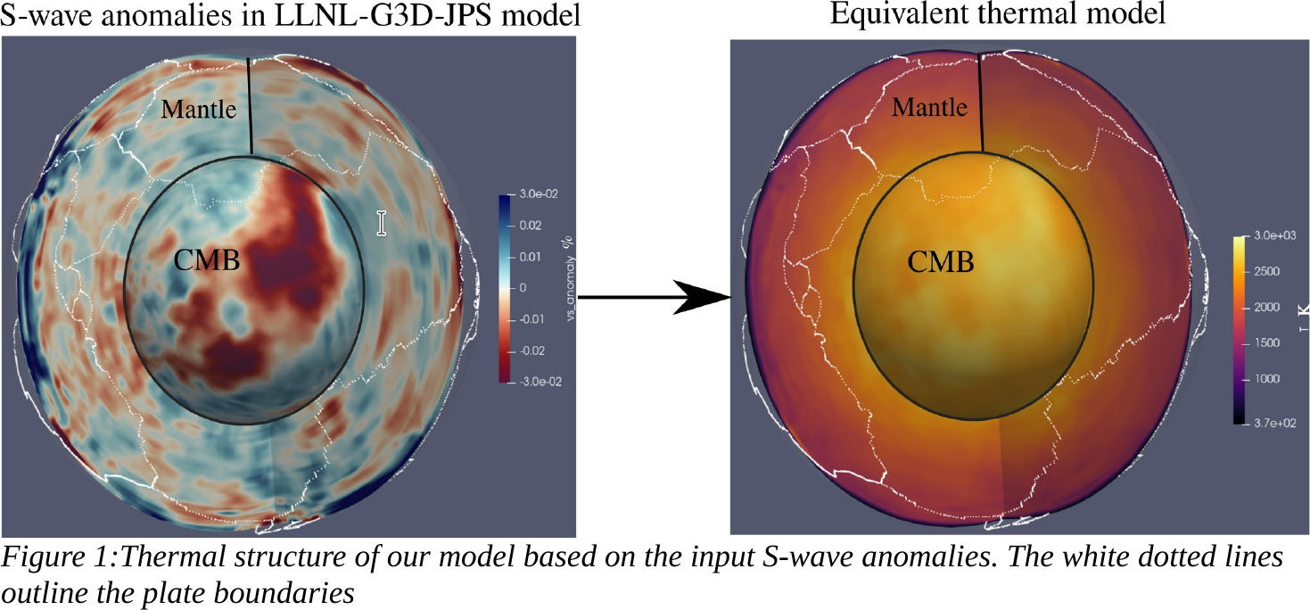
1) Input global tomography model: Several global seismic tomography models have emerged since early 21st century revealing detailed heterogeneity throughout the mantle. The models differ in the input travel-times of a seismic phase and frequency content of that phase. Currently, we use the joint P and S wave tomography model, LLNL-G3D-JPS, by Simmons et al.,(2015) with a resolution of ~1 degree in the upper mantle and ~2 degrees in the lower mantle.
2) Density model: Our models are driven by buoyancy forces which are calculated using depth-dependent scaling of density anomalies with the S-wave anomalies. We base densities in the crust from Crust1.0 model (Laske et al., 2013) averaging over the upper crust, middle crust and lower crust layers.
3) Temperature model: We compute temperature variations from a mantle adiabat using a constant scaling factor, -4.2, with the S-wave anomalies in the global tomography model (see Figure below). The lower wavelength variations heterogeneity expected in the upper mantle are often smoothed in the global tomography models. Therefore, we use a high-resolution temperature model (TM1 in Tutu et al., 2018) in the top 300 km that includes the variable ages of continental lithosphere, cooling of oceanic lithospheres and cold slab structures.
4) Plate boundaries: We prescribe plate boundaries from the Global Earthquake fault database in WorldBuilder, an open-source code that can prescribe complex initial conditionsin geodynamic models.
5) Rheology computation: We use dislocation and diffusion creep with different prefactors for different mineral phases. The average lateral variations in viscosity are scaled to a reference viscosity profile (Steinberger and Calderwood, 2006) that is consistent with the observed geoid. Additionally, we weaken the plate boundaries to localize deformation along them.
We include all these components in a modular fashion to test the relative importance of each component to best-match the surface GPS observations.
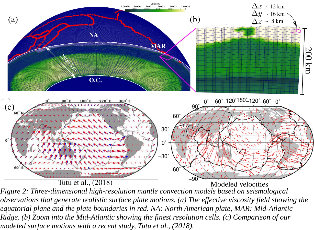
To resolve the high deformation at the plate boundaries, we use adaptive mesh refinement in ASPECT. Our current highest-resolution models have refinement cell size of up to ~ 10 km: